Drone Operators
Onboard intelligence for inspection, delivery, and mapping
Real-time object detection, terrain analysis, and mission autonomy for commercial UAV fleets operating beyond visual line of sight.
“Every gram of compute costs flight time, which makes model efficiency an airworthiness question, not just an engineering preference.”
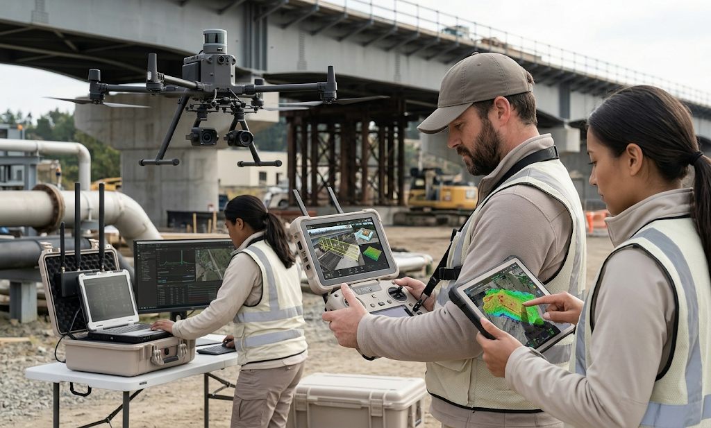
Commercial drone operations have moved well past aerial photography. Utilities inspect thousands of miles of transmission line, energy companies survey flare stacks and pipelines, logistics providers trial last-mile delivery, and surveyors produce centimeter-accurate maps of active construction sites. What these missions share is a need for intelligence onboard the aircraft, detecting infrastructure defects in real time, avoiding obstacles, and adjusting flight paths when connectivity drops.
Drone operators need models that run on constrained compute with tight power budgets. Every watt drawn by an onboard computer is a watt unavailable to the propulsion system, and every gram of hardware shortens flight time. Aerbix compiles models for onboard GPUs and companion computers, quantized and pruned for the airframe's exact power envelope, then manages updates across the fleet without manual SD card swaps in the field.
Why inference belongs onboard
Beyond-visual-line-of-sight operations are the economic unlock for the industry, and they assume degraded connectivity as a baseline condition. A drone inspecting a remote pipeline segment cannot depend on streaming video to a ground station for analysis; it must recognize corrosion, vegetation encroachment, or unauthorized activity on its own, then prioritize what to record and what to transmit when a link is available.
Onboard inference also changes mission efficiency. Instead of capturing everything and analyzing footage back at the office (a workflow that can take days), the aircraft flags anomalies mid-flight, revisits them for close-up capture, and lands with a structured defect report rather than hours of raw video. Operators routinely cut analysis turnaround from days to minutes with this pattern.
Fleet operations without SD cards
The unglamorous reality of drone programs is logistics: dozens of airframes across regional depots, each needing model updates, firmware alignment, and configuration matched to the mission and jurisdiction. Manual update workflows do not scale past a handful of aircraft, and they introduce exactly the kind of version inconsistency that regulators scrutinize.
Aerbix delivers signed over-the-air updates when aircraft dock for charging, tracks which model version flew which mission, and surfaces inference latency and thermal telemetry per airframe. Mission planners get health signals for every aircraft, making it easier to certify recurring inspection routes and demonstrate operational control to aviation authorities as fleets scale from a handful of pilots to true fleet operations.
Scaling the program
As programs mature, the questions shift from can the drone see the defect to how does the whole operation run at scale, how models are validated before deployment, how detections feed asset-management systems, and how per-flight compliance evidence is generated automatically. Aerbix answers these questions with the same fleet primitives used across robotics and vehicle programs, letting drone operators grow flight volume without growing back-office headcount to match.
The operators winning long-term inspection and delivery contracts are the ones who can demonstrate not just flight capability but operational maturity: consistent software baselines, documented model performance, and update discipline across every airframe in the hangar. Onboard intelligence gets a drone program started; fleet-grade software operations are what let it scale into a durable business.
Discuss this deployment
Our solutions team helps map Aerbix to your fleet, licensing model, and integration requirements.
Talk to Aerbix